Living in Ipswich, on the threshold between Brisbane and the Magnificent Scenic Rim, we are spoiled for choice when it comes to natural rainforests, gardens, walking trails, ancient volcanic mountains with views and waterfalls, and small boutique-shop towns to explore. Hubs and I are not coffee, wine, cheese and produce connoisseurs, but there are foody options galore as well. It’s time for a brief listicle of just some of our favourite attractions in day-tripping or weekend camping distance of Ipswich, Brisbane and the Gold Coast.
- TAMBORINE MOUNTAIN (Or is it Mt Tamborine?):
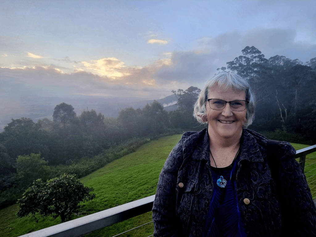
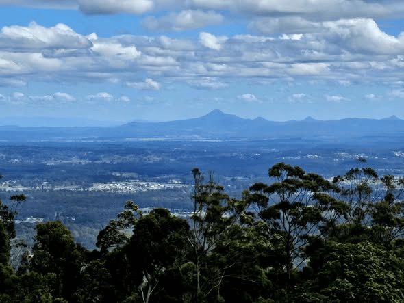
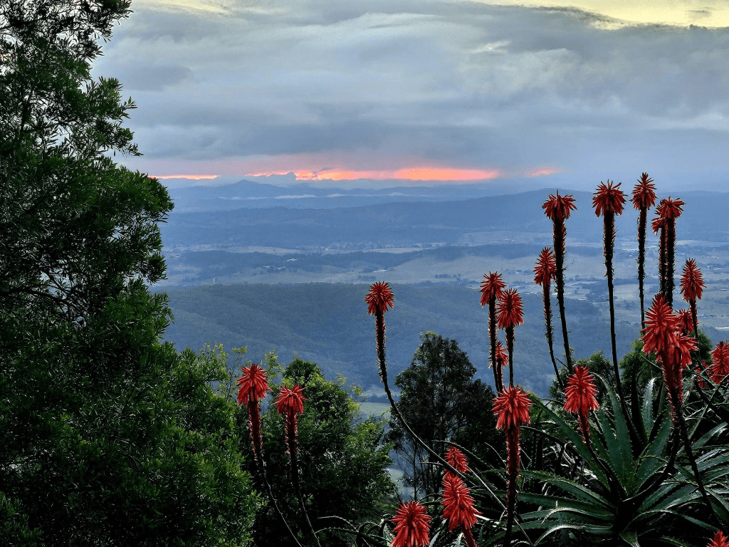
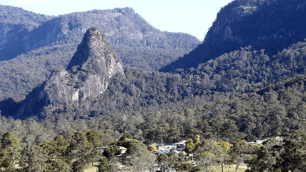
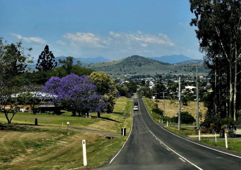
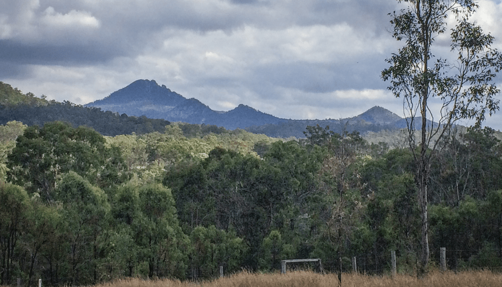
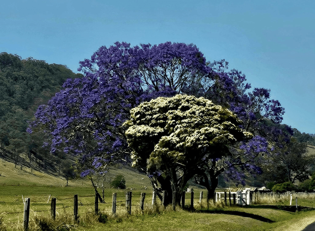
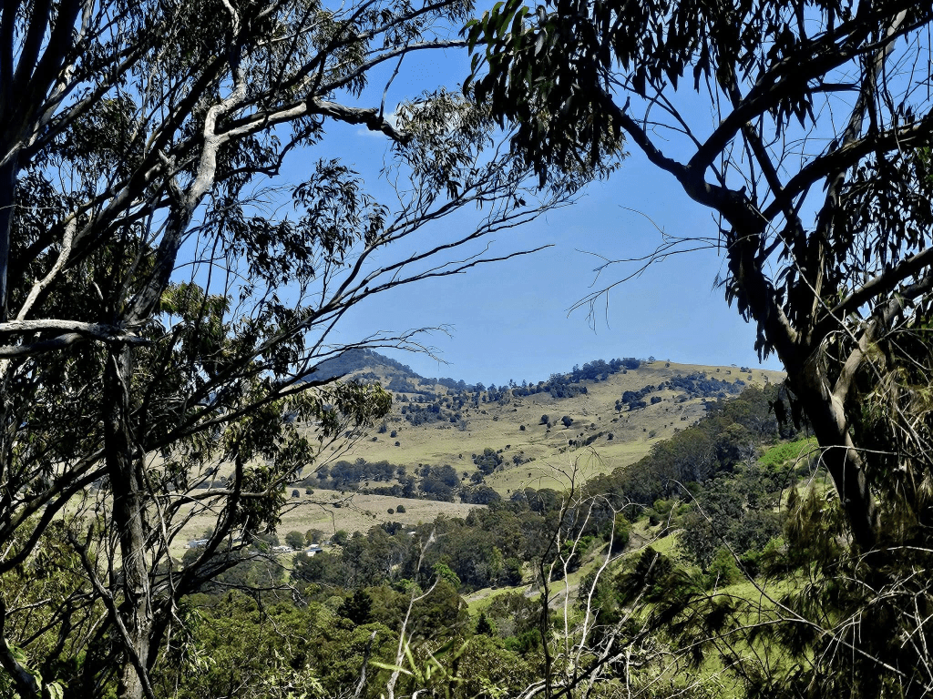
Tamborine Mountain is an actual geological mountain, resulting from a long-ago lava flow from Mt Warning. Its slopes are covered in lush rainforest, with a string of beautiful villages perched along its ridge. The views in all directions are the attraction. Illustrated is the view towards Mount Boonah. Ipswich and Brisbane are to the right and can be seen on a clearer day.
It’s just over an hour with a good run down the motorway from Brizzie, a bit further than this from Ipswich and about half an hour from the Gold Coast. Beware the roads in from either Tamborine Village or Canungra. Both are narrow, winding and steep. That is probably why there are no caravan parks on the mountain. The picture is taken from the veranda of a private home in Eagle Heights, where I sometimes meet with my writers’ group.
Our favourite experiences so far in Tamborine Mountain include:
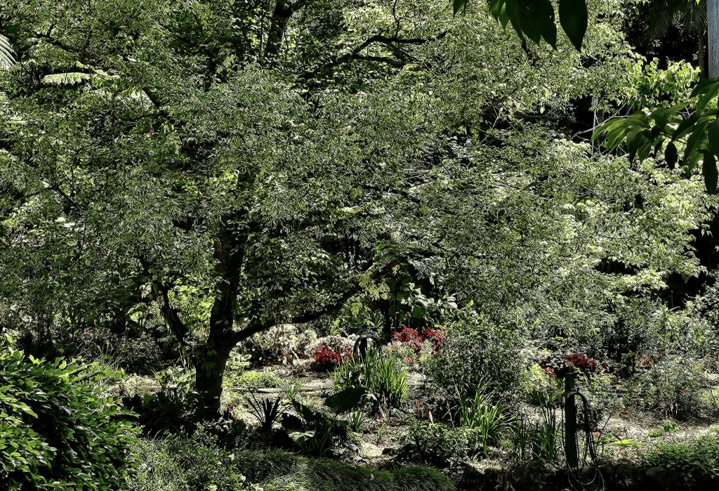
The Tamborine Mountain Botanic Gardens
Entry is free to the nine hectares of landscaped sub-tropical beauty, criss-crossed with meandering paths. Some are quite steep and would be unsuitable for the physically challenged.
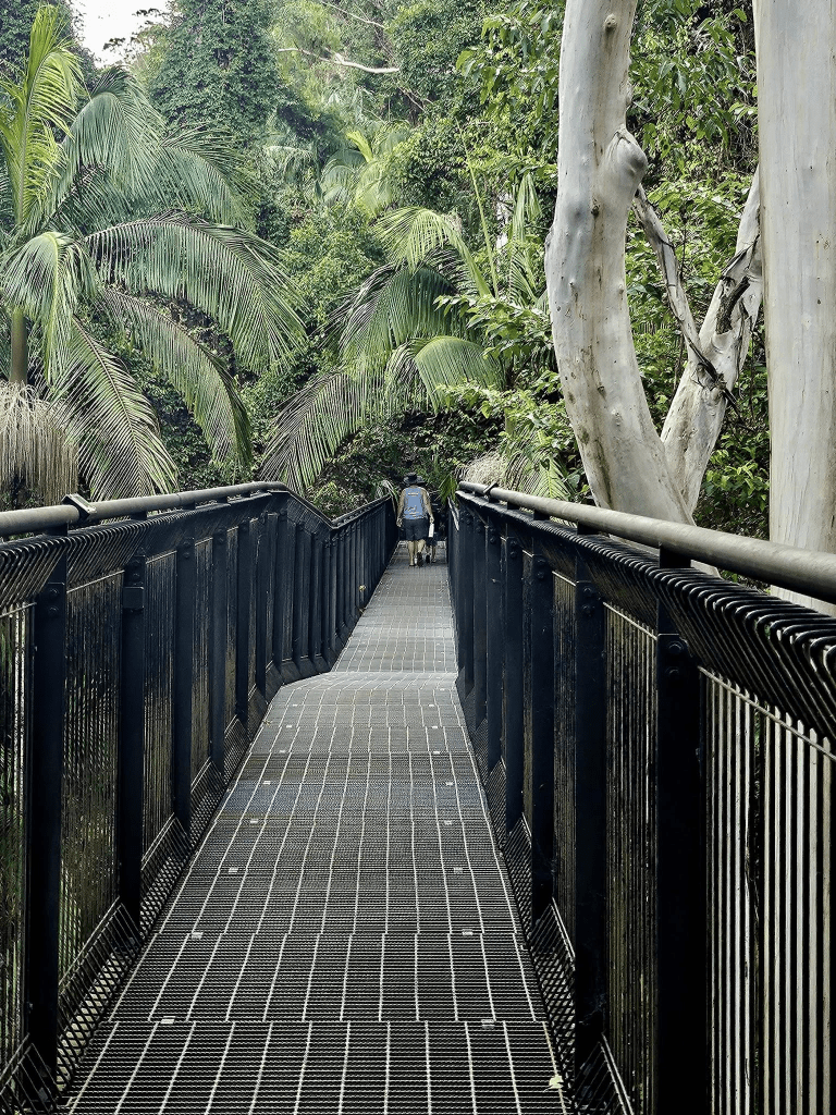
The Tamborine Rainforest Skywalk
You enter through a small information centre/cafe/ticket office/souvenir shop. Tickets are currently $21.50 for adults and $18 for old farts with concessions. There are also, obviously, children’s prices and family passes. The ‘skywalk’ is a board walk through the canopy of the rainforest with the return trail winding backwards and forwards over and beside a rushing creek with the opportunity to touch stock-standard ferns and trees and orchids and moss-encrusted rocks and the possibility of seeing/hearing/photographing wildlife and birds (although not when there are lots of kids on the Skywalk, sadly).
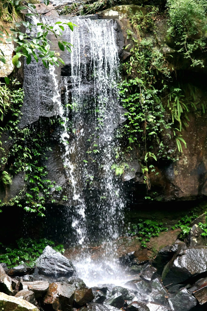
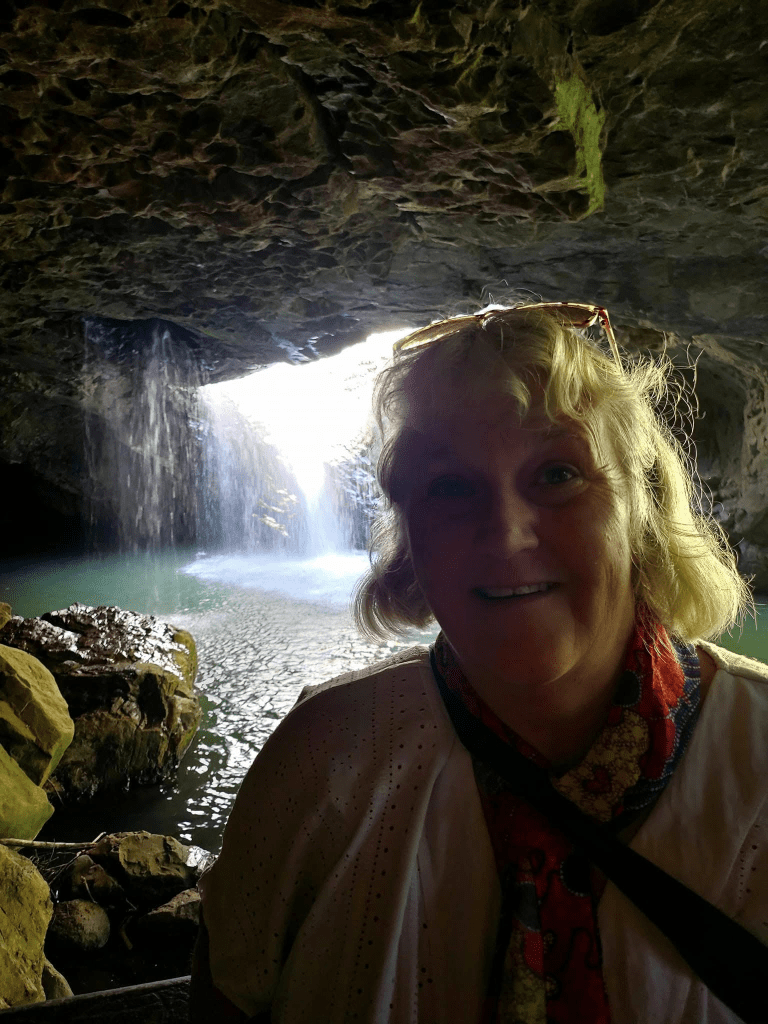
Waterfalls and Cascades
There are four waterfalls (that I know of) in the Mt Tamborine area. Reaching all of them involves a bit of walking.
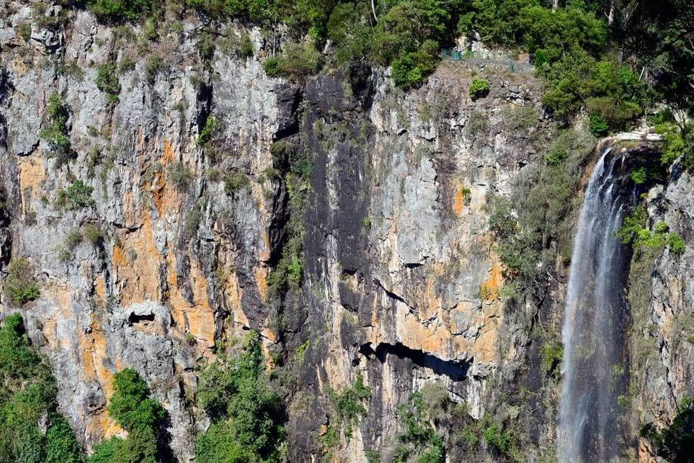
— Cameron Falls,off the Knoll Road, is reached by a round loop walk of about and hour. Check out the view to the west just after crossing the concrete bridge over Sandy Creek.
—Witches Falls, is quite a difficult 3.6 Km walk through changing vegetation, mainly open woodland, from the Main Western Road. Being located on the “Witches Chase” hiking track, the falls are best admired from the viewing platform also offering great inland views. Witches Falls Winery is nearby and there are also some accommodation cottages.
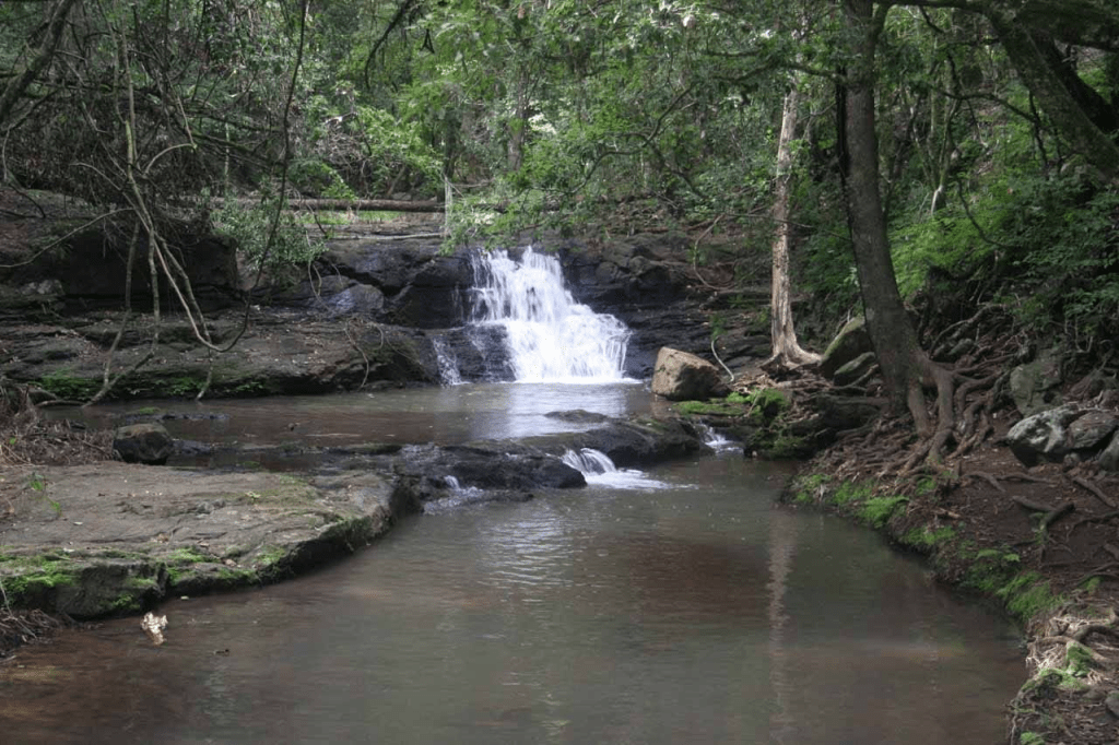
—Cedar Creek Falls, the easiest to reach on a 500m walk from the carpark (which has very limited parking space). Several swimming holes below the falls are reachable by scrambling across some boulders.
—Curtis Falls, which is viewed from across the pool below, is 500m down through a beautiful forest and then 500 metres back up to the large carpark at the top. Turn left from Eagle Heights Road. Oh how majestic the gallery of trees over the path is and how soft and moist the leaf-litter carpet is underfoot!
(photo courtesy of L. Kelly)
Sunset Heaven Japanese Ryokan and Spa
Surrounded by the scent of eucalypts, the calls of whipbirds and pademelon wallabies, Sunset Heaven is not exactly a Japanese Ryokan—there are beds rather than futons on the tatami mats on the floor. It’s not exactly an onsen—the spa and rock pool are not fed by a hot spring. But there are karesansui (a Japanese rock garden), a stone washbasin, and a genkan (shoe-removal porch), a tokunoma (alcove with a hanging scroll) and a gold Japanese furnishing motif in the accommodation (which can be booked through Air BnB). The views of sunset and the stars on a clear night from the deck would be magical.
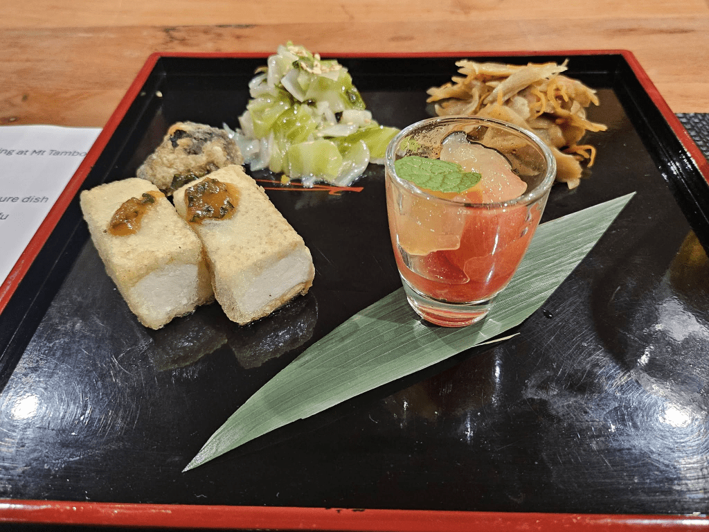
We have not stayed there, but recently attended a sunset and stargazing experience (concert? dinner party?) at Sunset Heaven, hosted by the dynamic Emi Yoshida, a woman of many talents and boundless hospitable vibes. The idea was that guests sat on the deck and listened to music as the sun set, followed by a Japanese meal, more music and stargazing. Emi-san and two of her children, Kaito and Keiko sans provided a very eclectic selection of music.
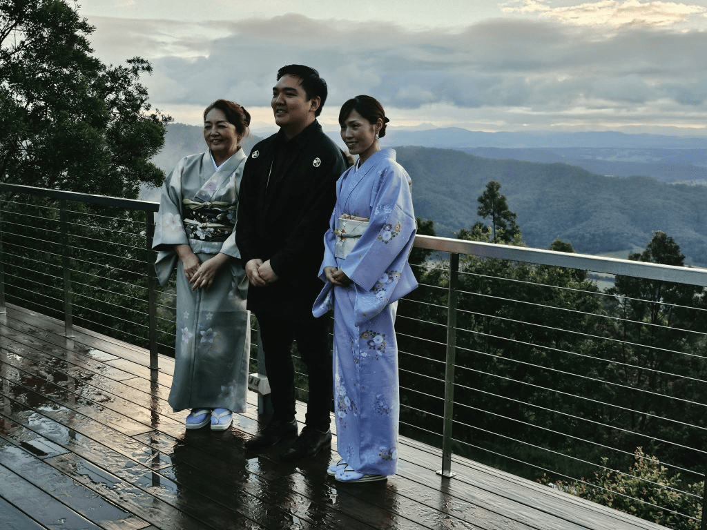
They are consummate musicians, and after dinner were joined by the chef, Aki-san, for a bracket of Okinawan folk songs. The clouds did not ruin the multisensory experience and the meal was a multicourse Japanese degustation menu, beautifully and authentically presented. My gluten-free requirements were catered for.
Emi-san also provides remedial massage and other forms of wellness therapy.
https://sunsetheavenryokan.com
The Gallery Walk Shopping Experience
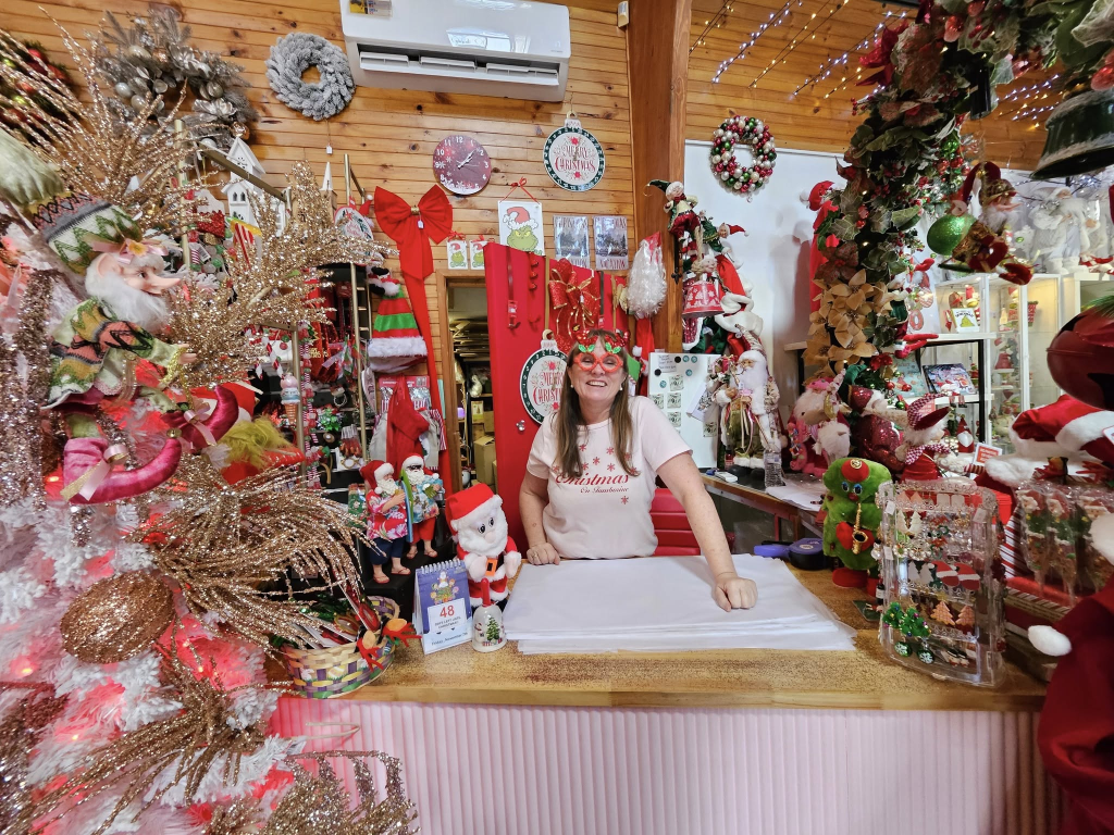
Gallery Walk is a block of artisan shops off Eagle Park Road (past the turn-off to Curtis Falls). There are the usual touristy sweets, crystals, arts and crafts, a glass shop, chocolates, cheese, fashion, kitchen Knick Knack shops, and also some unique standouts — Christmas on Tamborine, an all-year round Christmas shop (ask the irrepressible Maggie to tell you about her elves which mysteriously move around the shop sometimes); The German Cuckoo Clock Nest, that is reminiscent of The Black Forest, A Wee Bit o’ Scotland and a craft brewery and a distillery as well as a wide variety of cafes. Most shops have ‘tourist hours’ from 10am to 4pm.
https://www.christmasontamborine.com
2. CANUNGRA
Just down the ‘goat track’ (as the locals call the series of one-lane hairpin bends descending Tamborine Mountain), is the picturesque town of Canungra, gateway to the Lamington National Park.
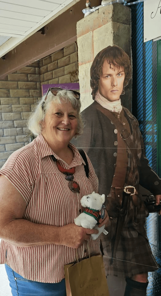
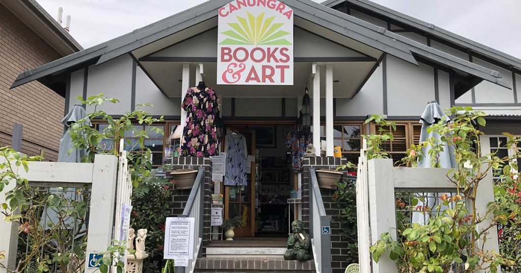
In Canungra there’s an ambience of oozing human talent. It’s apparent in numerous murals, a plethora of interesting artisaneries and craft shops, an abundance of nosheries (The pie shop is famous and the Outpost Cafe serves a magnificent breakfast, if you can find a table that’s not occupied by bikers) and my all-time favourite temptation shop set in a delightful old Queenslander building and selling beautiful artwork and books by local authors and QUALITY secondhand and classic tomes. So many biblio-treasures; so little spending power! Be sure to check out Canungra Books and Art, especially the beautiful cards and fridge magnets by talented Tamborine Mountain artist, Gaye Dell.
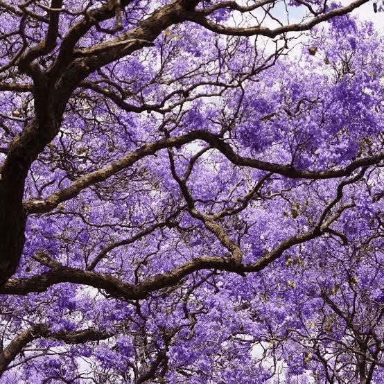
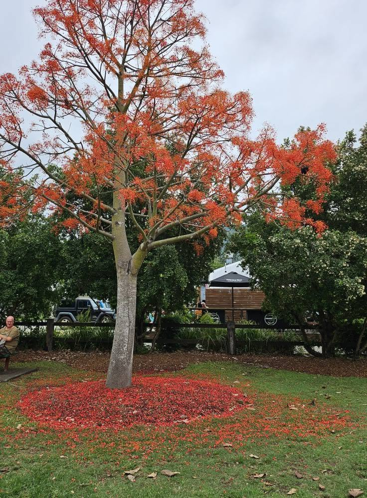
The most picturesque time to visit is when the jacaranda trees are flowering in November. This is also when the flame trees are flowering. In Canungra, they’ve replaced the poppy as the flower of remembrance.
We camped in a powered site at the Canungra Showground Campground next to idyllic Canungra Creek. The facilities are well-maintained, but remember to take gold coins for the showers.

3. LAMINGTON NATIONAL PARK ( and O’Reilly’s Rainforest Retreat)
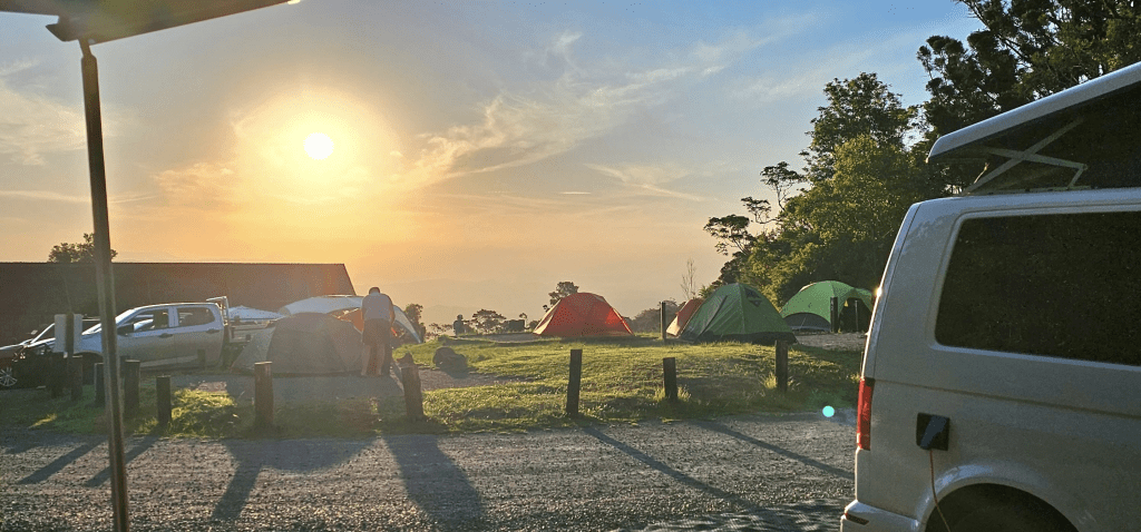
Lamington National Park contains remnant pieces of awe-inspiring Gondwana Rainforest. O’Reilly’s, 35 Km beyond Canungra and about two hours from Brisbane, is where you should base yourself if in Lamington National Park. There are various types of accommodation, but the view of the sunset from the camping area is magical (not so my photo).
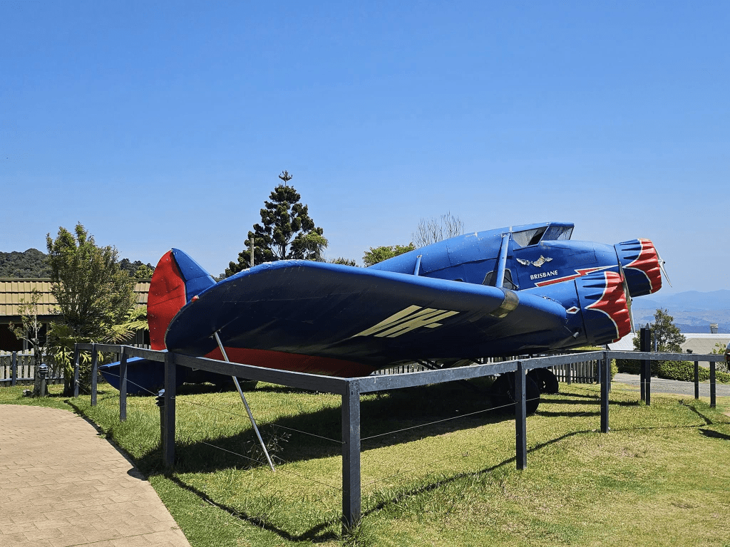
It’s a long, windy drive up another mountain road, which is not suitable for caravans. The Centrepiece is a plane and a statue of three men. As the story goes, a Stinson Airliner took off from Brisbane in 1937. Many assumed it crashed in New South Wales. Except local Bernard O’Reilly who set off on a search with nothing but a gut instinct. He found two survivors and the body of Jim Westray who had tried to go for help. His body was buried by Christmas Creek (which we have yet to visit).
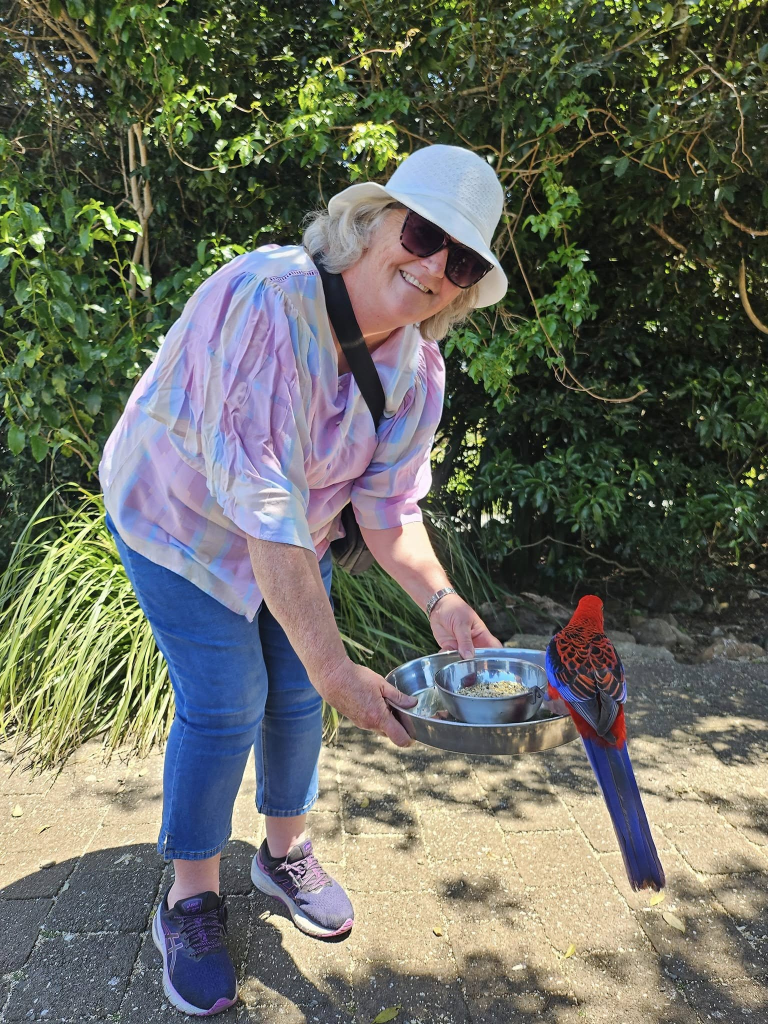
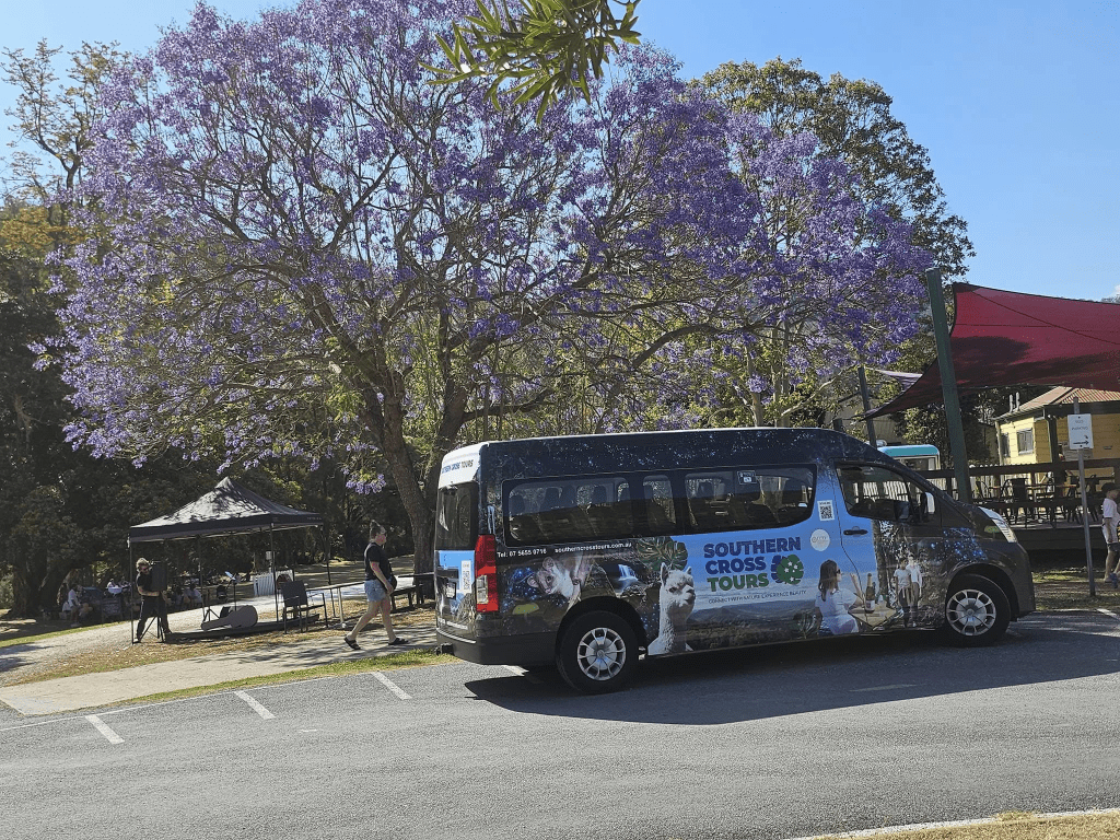
Birdlife abounds in the rainforest on all the walks, although if time is limited, perhaps the main boardwalk through the canopy is the best for hearing and glimpsing bush turkeys, whipbirds and many others (Can you tell my husband is the twitcher rather than myself?) I do know you can feed the rainbow lorikeets late in the morning when the tour bus from Southern Cross Tours out of the Gold Coast arrives (thoroughly recommended). There is also a Birds of Prey Show, which is very interesting, though swelteringly hot sitting out in the open away from the trees.
Our first time to O’Reilly’s was with Southern Cross Tours and we also visited O’Reilly’s Winery at the bottom of the mountain. There’s a creek to dip your feet, alpacas to pat and a more than adequate variety of pub-style lunches.
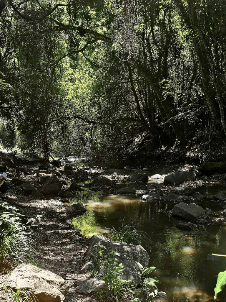
The second time we camped for the weekend. The highlight was going to see glowworms on a high bank of Moran Creek which also has leeches, giant cricket things and blue and red freshwater crayfish. In the daytime, it is an ordinary rainforest stream.
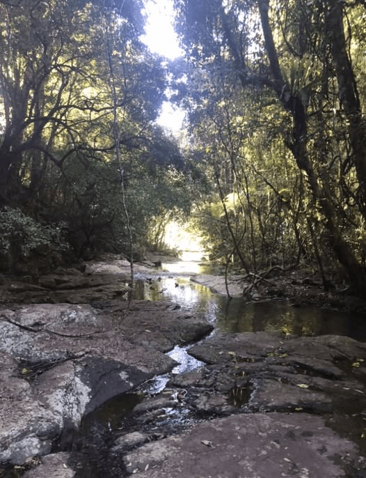
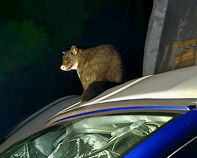
What a magical adventure! No phones or cameras allowed, but if you can imagine a galaxy of stars tipped on its side so you are facing tens of thousands of pinpoints of blue-white light, that’s what it’s like. Led lights maybe. It had just rained and the moon was behind clouds, so the little buggers were extra bioluminescent. Running water and Fleahys Bar frogs and cicadas provided the backing track. It was moist and soft and special, and we also glimpsed a bandicoot and a pademelon wallaby and the Fleahy’s frog which was thought to be extinct till a healthy population was discovered in Lamington National Park. When we arrived ‘home’ to our van, a possum was trying to break in to it.
4. SPRINGBROOK NATIONAL PARK
In the hinterland 45Km from the Gold Coast and just 100Km from Brisbane’s, the ancient wonderland of rainforests, waterfalls, escarpments, rock formations and valleys that is Springbrook National Park makes for one of south east Queensland’s most spectacular day trips.
We drove up the Numinbah Valley towards Egg Rock along the Nerang Murwillimbah Rd from the Gold Coast. There is no public transport, but Southern Cross Tours brings day trippers to Springbrook regularly.
High altitude and dense tree cover keep the temperatures cooler than any split system can lay claim to. Hubs had his eye on the canopy and his camera lens ready to go.. Crimson rosellas flashed brilliant red, yellow and blue through the treetops, while curious king parrots seemed to be hanging around picnic areas and lookouts. If you’re lucky, you may hear the rare Albert’s lyrebird (only 3500 left and only in this area), mimicking the calls of other birds from deep within the forest.
The most accessible and popular walk is Natural Bridge – arguably Springbrook National Park’s most famous feature – which takes about an hour to complete and is suitable for little legs, tired feet and even those who forgot to pack sneakers. At the bottom of a paved path, a glittering cascade pours through a basalt cave, completely backlit by natural light.

Springbrook National Park is part of the world heritage listed Gondwana Rainforest, a remnant of 100 million years ago when Australia was part of the giant southern-hemisphere continent and still attached to Antarctica, including the awe-inspiring Antarctic Beech Tree.
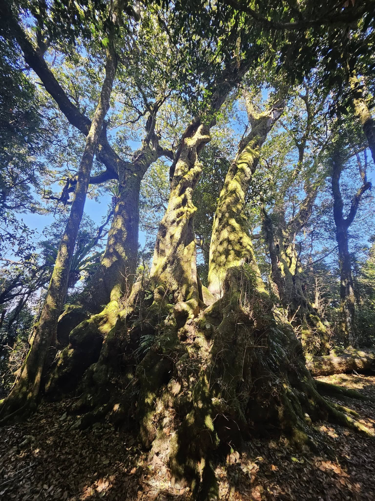
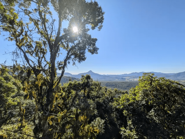
We saw a stand of Antarctic Beech trees beside the walking track to ‘Best of All’ Lookout, which would have had amazing views of northern NSW if it wasn’t so smoky. We could see Murwillumbah and the shape of Mt Warning through the smoke, but the blue sweep of Byron Bay had to be imagined only.
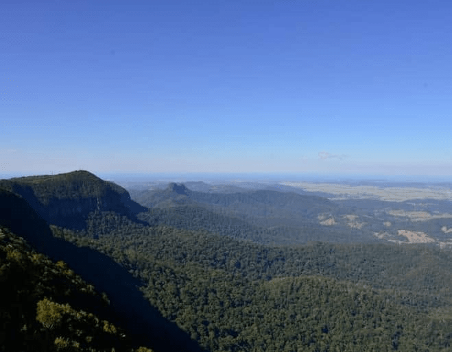
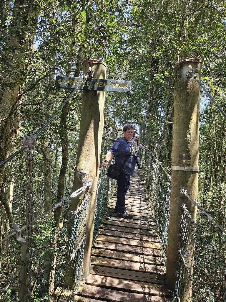
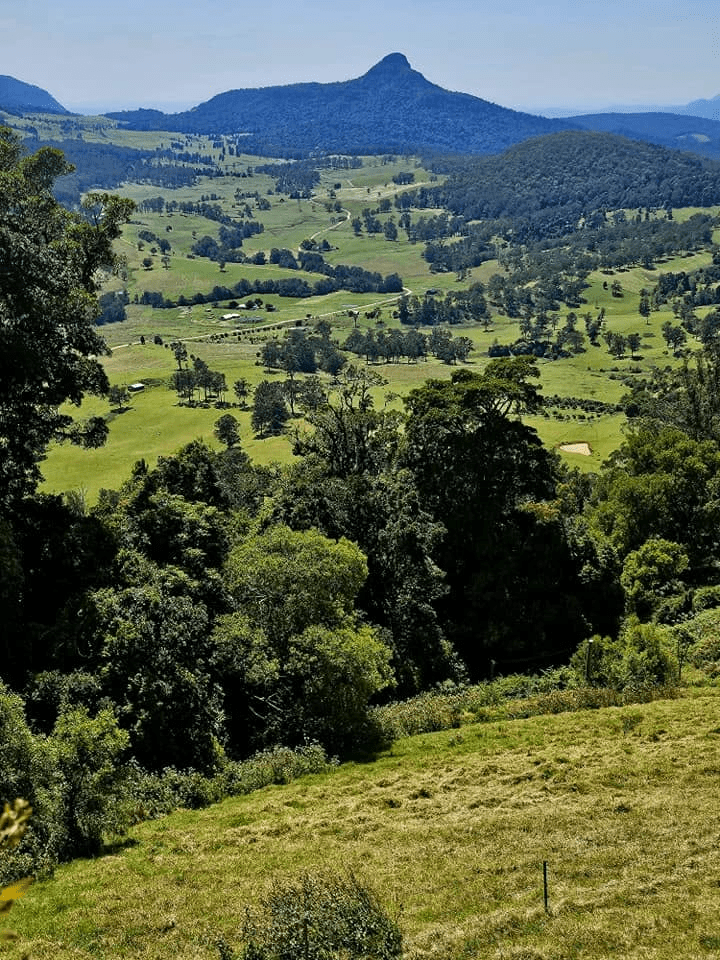
We also visited Canyon Lookout, arguably the most accessible, with sweeping views to the Gold Coast, but the buildings were just vague shapes once again. It would be the only lookout we visited that is pram and wheelchair friendly. The photo below is from Purling Brook Falls Lookout.
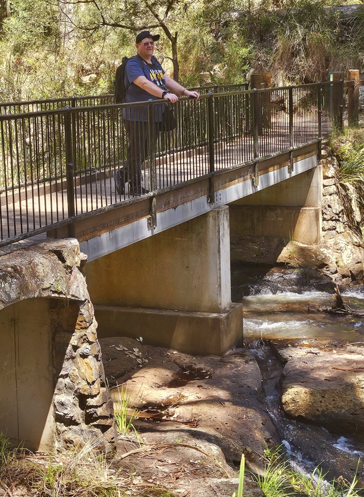
Accessed by a suspension bridge that hangs over the creek and rainforest canopy, Purling Brook Circuit to the bottom of the falls, is a 4km return trip. We left that one for next time.
The main camping area is close to the Purling Brook Falls Lookout. It’s called ‘The Settlement’. There are also self-contained cabins.
5. Close to Home (The Ipswich End of the Scenic Rim)
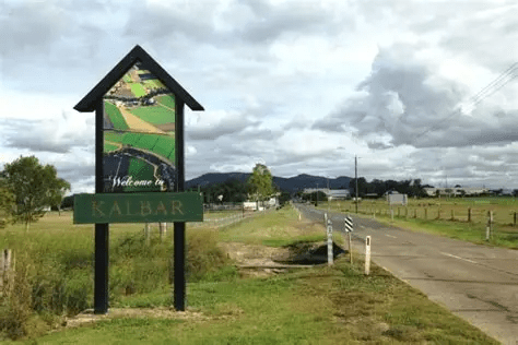
‘Kalbar’, in reference to an area in the Scenic Rim, and pronounced something like ‘Cow Bar’, means either ‘bright star’ or ‘dead’ in the local Munujali language. Settled by German immigrant farmers in the 1870s, Kalbar’s pioneering heritage can be seen in historic buildings and welcoming cafes, pubs, providores and bakeries that offer hearty homestyle food with locally grown produce.
Smaller historic towns nearby include Roadvale, Harrisville and Peak Crossing, each with its own pub and main street, but Kalbar is the hub and just oozes country charm. Meandering down the main street is reminiscent of a visit to Hahndorf in the Adelaide Hills. Indeed, Kalbar used to be called ‘Engelsburg’ until WWI when the name was changed in an attempt to de-Germanise the area’s image. Driving into Kalbar from the direction of Roadvale, you may notice a row of old houses running up the hill which you can just bet once had an address in Engelsburg in the days when the mailman trekked out on horseback once a week from Ipswich, a distance of about 44 Klicks.
For specialty gifts, local produce and handmade collectibles, Kalbar’s main business area is brimming with character ‘finds’ including Postmaster’s Sweets, located in the Post Office, and having a mouthwatering selection of fudges and old-fashioned designer sweets such as bullseyes, on display. When we found the shop empty, we shed our indoor voices and cleared our throats a few times to get service. Total open honesty. It closes on Saturday afternoons.
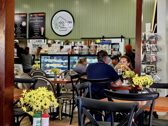
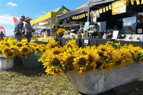
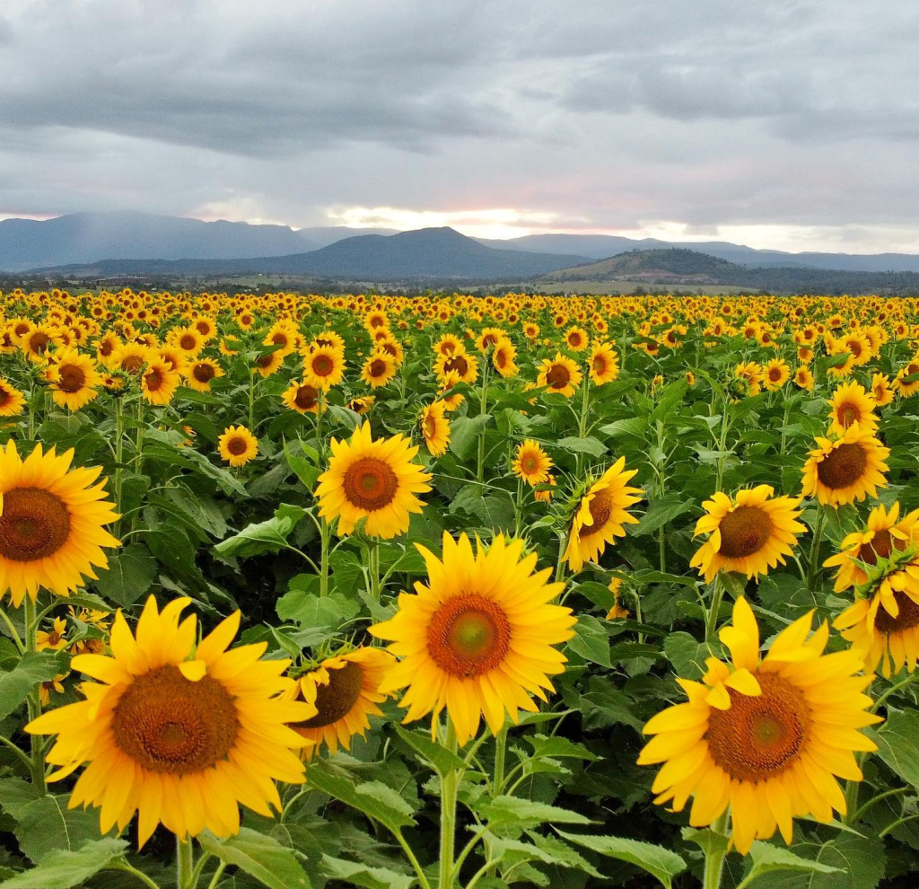
We brunched at The Country Soul Collective Cafe and Giftshop. The nostalgia for Loz’s Coffee and Gifts (my little shop in Ivanhoe NSW for a time) was overwhelming, although there’s a subtle motif of sunflowery gifts which allude to the annual Kalbar Sunflower Festival (google it—there’s a special story attached) held in mid to late autumn each year. Glad they chose that festival’s theme for the decor rather than the rather allergenic alternative— the ‘Hay Bale Festival’ held on the third weekend in October.
Country Soul has a small range of vacuum-sealed local wurst near the the till and more staff than Loz’s had. Lunch arrived in a flash. My steak sandwich on gluten-free bread was delectable. The verdant-plant-festooned Lovetts’ Cafe across the main drag was also thumping.
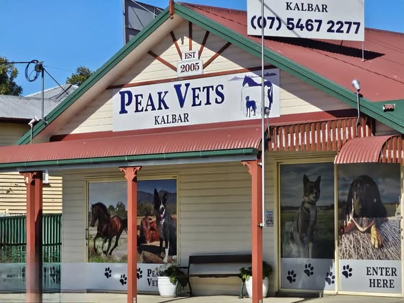
All the usual small-town businesses—bakery, butcher, pharmacy, motel, Spar Supermarket and a thematically muralled (spelling?) Vets’ — are interspersed with the boutiquey places catering for the day-trippers from Brizzy, The nearby ‘swich and The Goldie. The friendly proprietor of the tempting Nanny Lou’s Lane dress boutique told us that the weekends are her briskest days. Hubs was keen to leave with his wallet intact or I could’ve contributed to her unofficial stats.
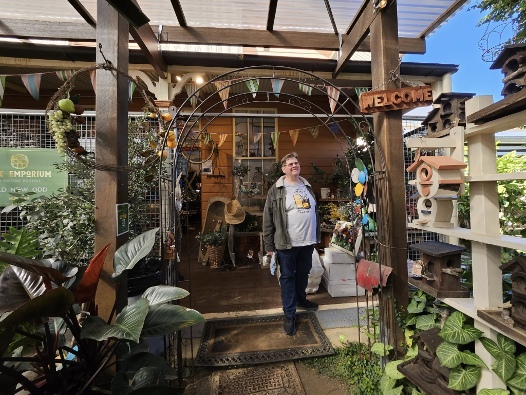
Our favourite shop is the Empire Emporium, located in the historic and spacious Wimm Bros building and crammed with, but not cluttered by, an eclectic range of everything you can imagine from saddles to chess sets, and flowing out the back into a whimsical gallery area. We loved what the artist had done with a variety of old musical instruments, which almost made up for the Emporium’s lack of collectible dragons. How refreshing it was for me, anyway, to walk out of such a place beside a man NOT clutching a dragon!
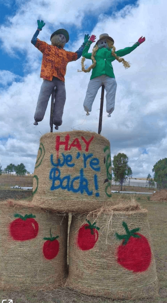
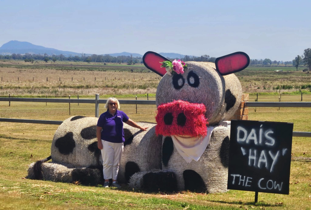
In mid-late October each year, the blockies and villagers centred on this wee township of Kalbar (population 1246 in the 2021 census) make effigies out of hay bales, give them a punny name and sit them outside their premises. Many of them are works of art and the whole setting of stunning, scenic-rim countryside is the best backdrop for hay creations.
It’s sort of like a cross between a treasure hunt/car rally and one of those nights when you drive round town looking at Christmas lights. We were unable to get a park anywhere in Kalbar that weekend, so headed for nearby Boonah and service with a country smile at The Old Boonah Butter Factory.
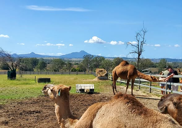
Summer Land Camels near Harrisville is a must-visit to see the resident camels and wander the charming homestead, shop and farm. Sometimes flea markets are held there, or should that be a ‘suq’ is held there seeing it involves camels? The usual stalls featuring pyramids of soap and bath bombs, mubaraks of harem-pants, candles containing pharoah-moans, bazaar wooden anubic objects and kanopic jars of mummified fruit and camel-toe jam take on an Egyptian ambience when in the presence of camels.
https://summerlandcamels.com.au/pages/visit-us
From our home, we can see a striking, craggy bit of geological work called variously Flinders Peak or the Teviot Range rising to the southeast. Matthew Flinders, who sailed around with a cat called Trim, doing voyages and stuff, spotted it in 1799, but he never actually went there. We did. It marks the northern boundary of The Scenic Rim.
The local Ugarapul people call Flinder’s Peak, Booroong’pah or Booroongapah or Booroongpah. It is a sacred site because they believe that the powerful spirit, “Yurrangpul”, lives there, and guards their traditions and sacred places. His name is similar to the local word for green tree frog: “Yurrang”. The green tree frog is the totem of the Ugarapul people and for most of the Spring we delighted at night in hearing them calling to each other from the drainpipes in our garden.
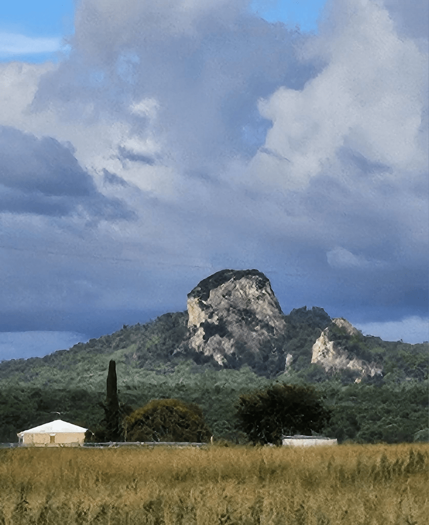
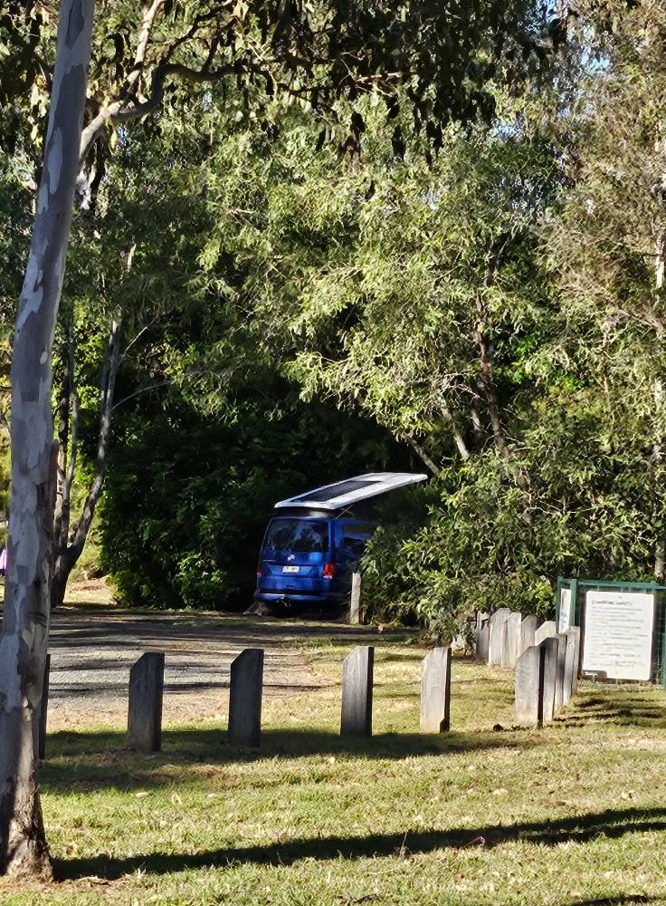
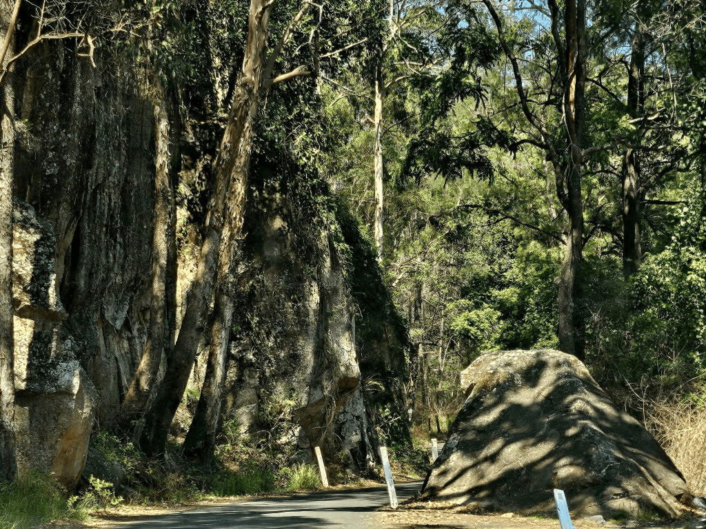
For a real bush-camping experience, complete with long-drop toilets and cold showers, you can’t go past Harding’s Paddock. You do go past Ivory’s Rock, pictured above. Harding’s Paddock is administered by the Ipswich Council and is at Purga, about 20 klicks from where we live. Down a dirt road, in the bush, nestling in the embrace of Flinders Peak.
Wake up to grazing kangaroos, peace and quiet, trees, birds and beautiful countryside. There are facilities to take your horse (!!) and a couple of hiking trails nearby. On the way in, down a dirt road, across a couple of creeks, you pass an aboriginal cemetery which we enjoy wandering around each time we go out that way. Each of the 16 campsites is separated from the next by trees, and, if you take your own wood, you can have a campfire.
6. The Queen Marys Falls Loop.
This drive, which we did as a day trip on the long weekend in October, starts in the Scenic Rim, but takes you through the edge of what is known as The Granite Belt. If coming from Brizzie, take the ‘Ipswich Central/Yamanto/ Boonah exit from the Ipswich Motorway and head towards Boonah.
A visit to open country has a special way of filling my soul cup – even in just a day – with its rolling green (sometimes) hills, rainforest canopies, rushing creeks and waterfalls and pace that lets you stop and stare without a timeline.
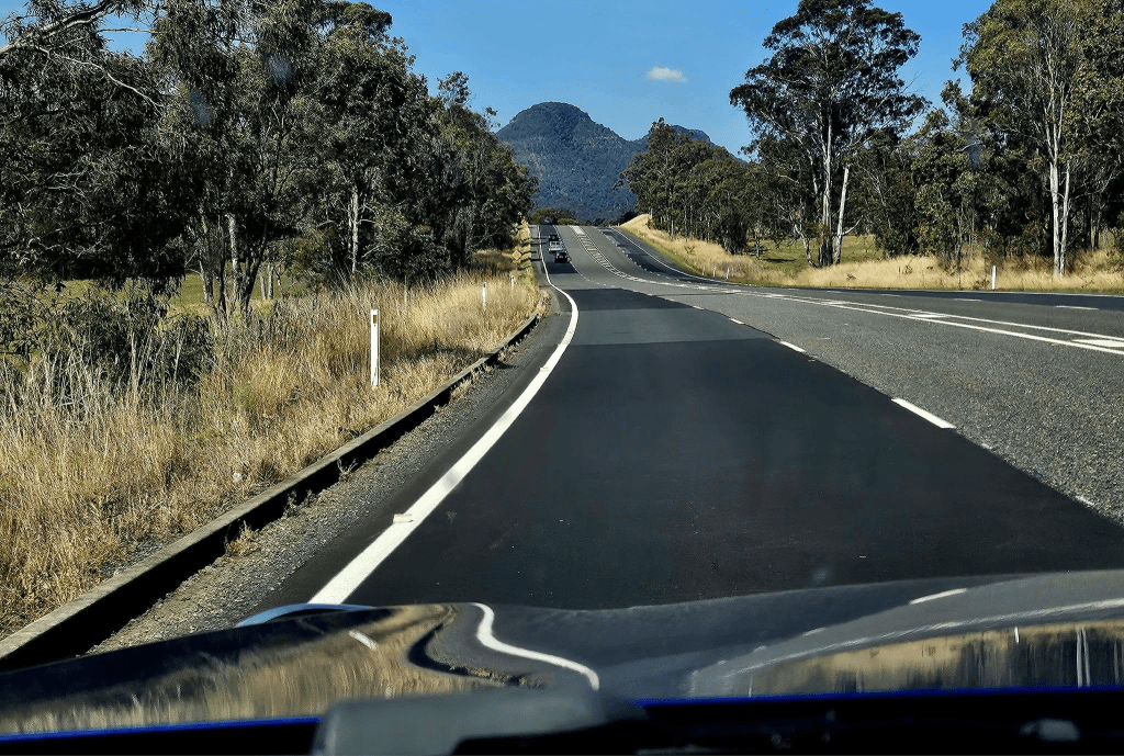
We headed southwest through Boonah, about 40 minutes south of Ipswich, and then wound up Falls Road through the picturesque Head (yes it is called that) and Teviot areas towards Killarney. There was a sign saying the road was not suitable for caravans, but we had to wait for and even back up for a plethora of wankers in four-wheel-drives coming the other way and dragging caravans and campers. You know you’re getting old when people doing the wrong thing piss you off. To be fair, we didn’t see a similar sign at the other end of the road.
The subtropical Gondwana rainforests of Main Range National Park date back about 180 million years to a time when all the continents were joined together. The volcano, of which Mt Warning is the remnant, that created the Scenic Rim spewed it all out about 25 million years ago.
First stop was The Moss Gardens Lookout. Walk only 25 metres along the 100 year old rabbit proof fence to view Hoop Pine, Kurrajong and Silky Oak trees and rocks dripping with lichen. Extend your walk to 300 metres along the undeveloped track for a pleasant view of Wilson’s Peak and White Swamp.
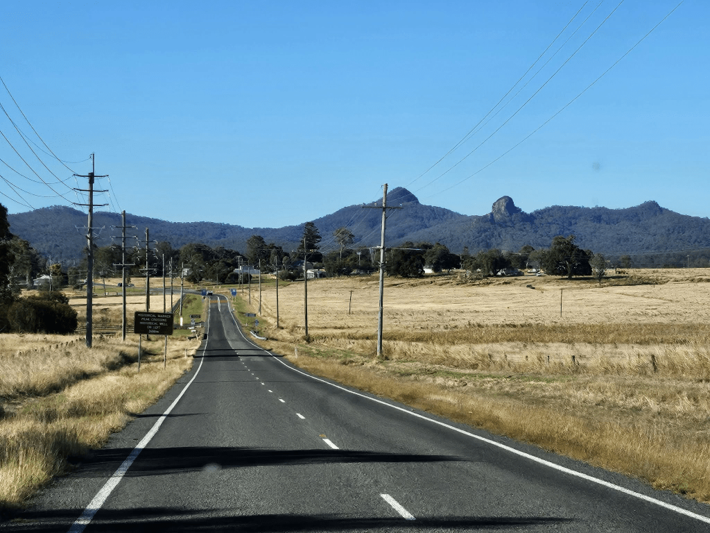
A further 3Km brought us to Carrs Lookout where an information sign identifies the mountains and tells the story of a plane crash in 1955 on Mt Superbus. We could contemplate the headwaters of the Murray Darling Basin and the start of the Condamine River. This may have been more impressive if I hadn’t grown up on a spur of the Nandewar Range on the watershed between the headwaters of the Gwydir and Namoi Rivers ( which blew me away when I was a kid). It was a gloriouser vista, however. You could just drink in the eye-candy of the Head Valley, Tambourine Mountain and Mt Superbus (yes, these are real names!). Several hundred bikers seemed to think so too, so we moved on to our main target stop for the day—Queen Mary Falls, about 8Km down the road.
Apparently the queen (wife of King George V) went to them on horseback as a child.
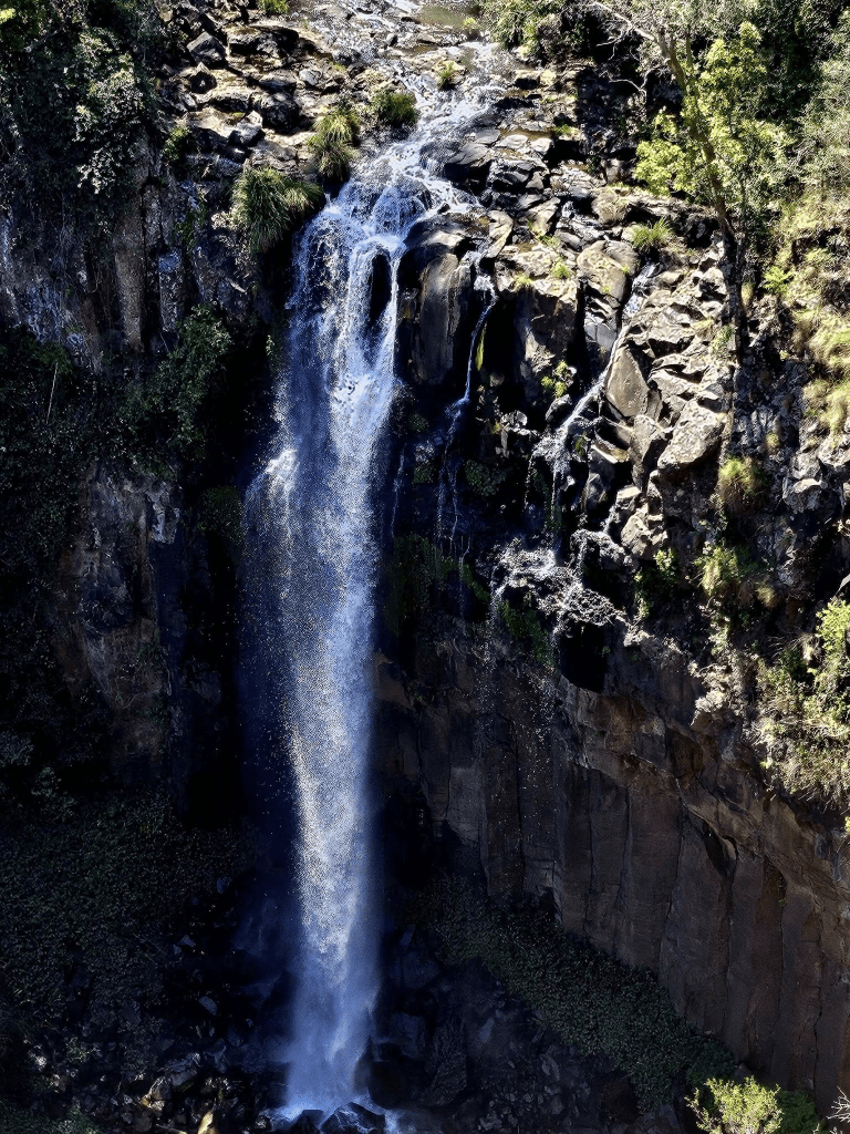
QMF is Spring Creek spilling over an ancient lava flow called trachyte after which it races on down to join the Condamine River. There’s a 2Km Circuit Walk that takes you to the bottom of the falls where you can gaze up and spritz your face in the mist. Although this’d been our original plan, we just did the clifftop walk (576 metres) because there seemed to be an infestation of kids swimming at the bottom of the falls, once again despite a prohibiting sign.
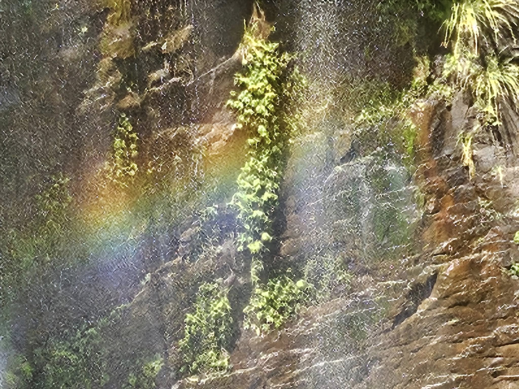
There is a picnic area with BBQ facilities and very clean toilets and a camping ground with cabins and a biker-attractive cafe across the road. And a great many people, so we moved on. We may well return and camp when it isn’t a long weekend. From the viewing platform, we could see an impressive rainbow in the mist.
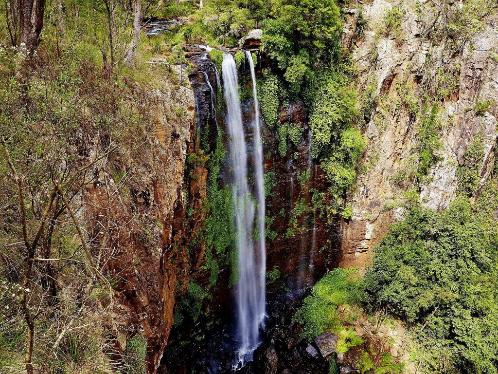
Literally round the corner is Daggs Falls. It is, this time, Teviot Creek which makes the 38m plunge and the really good news is that the viewing platform is right beside the road.
The high rise view to the McPherson Range is awesome. Mr Dagg was the postmaster at Killarney.
Browns Falls is a couple of clicks further on (and only about 4.5 clicks from Killarney). Once again, the picnic ground was thumping with families. The walk to the Falls is 600 metres through a tunnel.
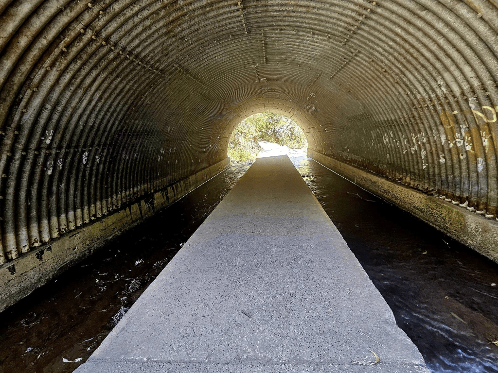
Easy-peasy till we discovered we had to walk along the creek bed over rocks and boulders.
We eventually glimpsed the falls in the distance and decided to come back to that one as well, with thongs or crocs and swimmers/bathers/togs, depending on where you grew up in Australia.
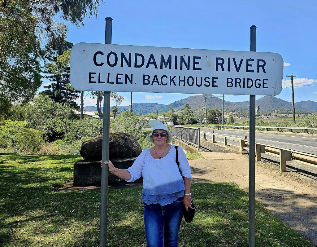
At this point, we were only a couple of Klicks from Killarney. We ate our lunch beside the Condamine in Tierny Park, there because we spotted the public toilet.
No kids and a lovely cool breeze.
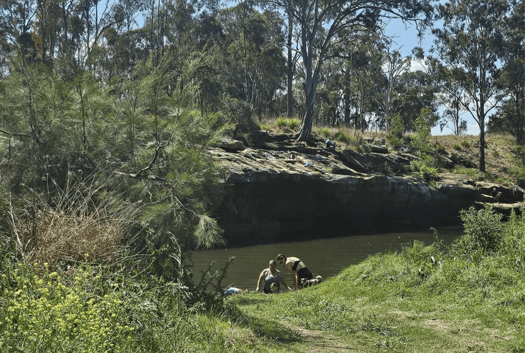
Hubs decided we’d come home via Yangan Rockies Waterhole where Google Maps told him he’d get some great bird photos. It turned out to be a popular swimming hole and there were lots of birds but they all had bikinis on.
So the return home was via Cunninghams Gap which took us back into the Scenic Rim.
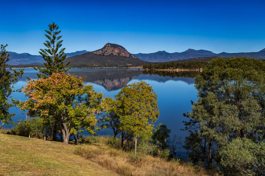
The small town of Aratula, at the bottom of Mt Edwards, is only 50 Km from home. It was bulging at the seams with people, so we didn’t stop. Nearby Lake Moogerah has a caravan park for campers. It is well worth a quick drive in just to have a look.
Thank you for taking this little tour with me of my favourite places so far explored in the three years we’ve lived in Ipswich. Happy Rimming!
If you have any comments or ideas, please post them under my link on my public Facebook page— Margaret R KELLY – Author & Travelling Raconteur

Leave a comment